


ATTENTION
This site is an unofficial listing of personnel that were in the Geodetic Survey Squadron/Group from July 1959 to October 1993.
For information on the web site contact
Garrett Moore or
Dick Winslow
If you spot any errors, accept our apologies and let Dick Winslow know about the needed corrections.
Newsletter #80, December 23, 2018 (Posted 12/26/2018)
Newsletter archives. Lots of interesting info in these "back issues". Adds perspective to how
much work Garrett does for the group. Check them out!
If you would like to contribute documents relevant to the Geodetic Survey Squadron/Group's history, please send them to Garrett Moore.
Allan Walcker has sent in several items documenting HIRAN and SHORAN work done in the 1950's. This material has been added to our Documents Page. You can access this material here.
Some interesting information on the early history of the military use of geodetic surveying techniques and the early origins of our Squadron / Group has been posted on our Documents Page. Look for the article from NOAA History: "The Aftermath of War: Rockets, Reconnaissance, and the Velocity of Light" accompanied by some comments from Allan Walcker.
Also this month, two project related documents from the 1960's have been added to the Documents Page:
I hope you will enjoy looking through these documents of historical importance.November 2019 on our Documents Page:
Bob Tyszka has sent in a collection of uniform patches to be distributed on a first-come, first-served basis. The patches are in two sizes: small (3-inch diameter) and large (3-3/4 inch diameter). Both sizes are basically dark brown in color. If you would like to receive one, please email Dick Winslow There are 4 large ones, and one small one. The top arch of the patches say, "Defense Mapping Agency", and the bottom arch says, "Geodetic Survey Group". To see an image of one these patches, Click here. There are still several of these patches available.
Also new this month are some photos of gravity field operations sent in by Billy Mayo. These new photos are on our "Photos" page. Click on Billy's name to access his photo collection
Recent Losses
Sad to hear of the passing of Col Martin Selinfreund and Bob Wideman. Details about both of these are still pending. Let me note here that Col Selinfreund was a past Squadron Commander who had also served as navigator on bomber runs over Europe during WWII.
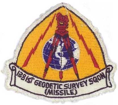
1381st Geodetic Survey Squadron Patch
Special thanks to Al Roberti for providing the image.The patch was the property of Jim Farrington (May he rest in peace). These are truly rare.
Reunion News...
Not much to say here, except that apparent interest in the once-every-3-year reunions has come to an end. If you read this notice and are still interested, please let Dick Winslow know by email, and he will see what can be done.
Update!
In a recent communication Dave Marcum pointed out an article found in Google's LIFE magazine Archive which covers the US Army's geodetic research. the article is found on page 124 of the May 12, 1958 issue. I hope you will look up the article.
Dave also mentioned a couple of other books he has been looking at for his research:
(1) "Accessory to War: The Unspoken Alliance Between Astrophysics and the Military" by Neill deGrasse Tyson, and
(2) "Inventing Accuracy: A Historical Sociology of Nuclear Missile Guidance" by Donald Mackenzie which Dave cites as, "still the standard work on the subject".
A Short History
Established in 1959 at Orlando AFB, Florida, as part of the USAF's 1370th Photomapping Group, the Squadron went through several evolutions in its name and organizational relationships, finally ending up as part of the Defense Mapping Agency (DMA) in 1972. The unit's various designations include:
- 1381st Geodetic Survey Squadron (Missile), 1959-64
- 1381st Geodetic Survey Squadron , 1964˝68
- 1st Geodetic Survey Squadron, 1968-72
- Geodetic Survey Squadron, 1972˝89
- Geodetic Survey Group, 1989˝93
Never a very large organization, it retained its unique status as a one-of-a-kind, lean unit of smart and dedicated people, a mix of military and civilian technical staff, that provided critical, high precision geospatial and geophysical information for defense and geospatial-intelligence needs anywhere in the world. During the 1960s, the Squadron and its detachments reached peak staffing with 69 officers, 361 enlisted, and 32 civilians. The Squadron was on call to carry out state-of-the-art geodetic surveys on short notice, and its adventurous field personnel spent much of their time deployed on missions lasting from a few days to many months, often in remote and difficult locations.
The Squadron headquarters moved from Orlando to Cheyenne in 1965, where it remained until it was disbanded in 1993 following the end of the Cold War. The Headquarters unit was also supported by a handful of small detachments primarily dedicated to supporting the positioning and guidance requirements of the ICBMs scattered throughout the mid-continent, test facilities in the Southwest and the important space and missile test launch sites at Cape Canaveral and Vandenberg AFB on the coasts.
After being disbanded, the Squadron's functions were first taken over by the Geodesy & Geophysics Office within DMA and now fall under the Office of Geomatics, National Geospatial-Intelligence Agency (NGA). For a more detailed history, go to "Our Ground Geodetic Surveyor Brethren" by Gordon Barnes.